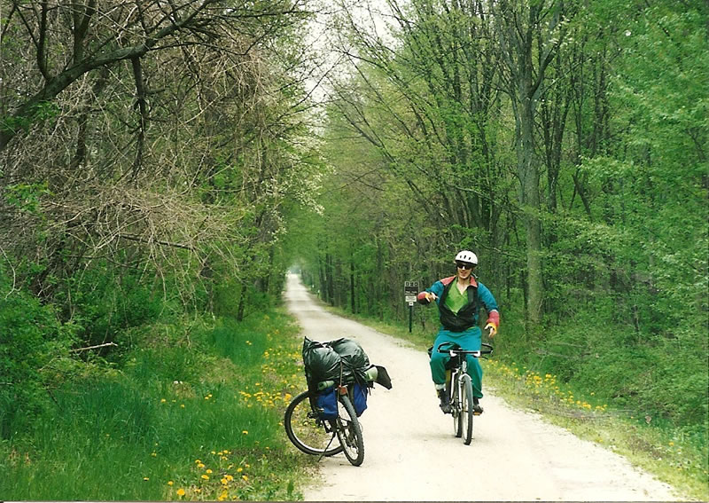
Terry cycling the Kal-Haven bike trail next to Ted's parked bike. Both bikes are loaded with camping gear.
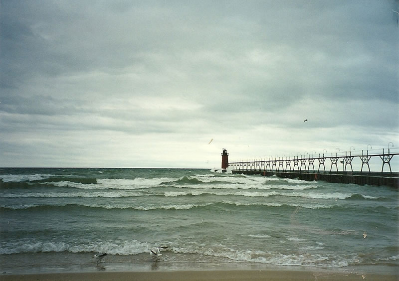
South Haven's Historic Lighthouse near city center of South Haven, Michigan.
Kalamazoo to South Haven - Trip 1
Kalamazoo to South Haven - Trip 2
Across Lower Peninsula of Michigan; Todd’s to Mitch’s - Trip 3
Across Upper Peninsula of Michigan; Prep for Alaska bike ride - Trip 4
Kalamazoo to South Haven - Trip 1
July 3, 1994
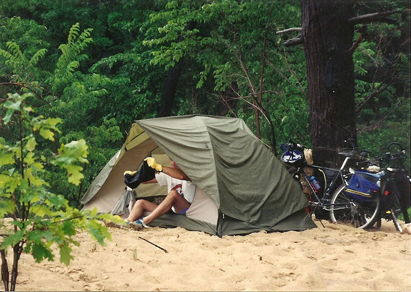
I went with Chuck Silva to Kalamazoo and biked to South Haven with our camping gear. We went for a cold swim in Lake Michigan. We ended up camping at the top of a sand bluff about ¼ mile before entrance to Van Buron state park. We had to ride up a short dirt trail to our camp site (illegal camping). That night we sat on the bluff with the misquotes and watched lightning coming our way (Chuck called it heat lightning). I ended up falling asleep outside and after about an hour it started lightly raining and Chuck woke me up. We then went into the tent and crashed for the night. About another hour past and Chuck woke me to say the storm is getting worst, he said “what should we do!” It was getting very windy, I did not know what to say. I had never been camping in wind that was that strong. The tent way actually flatten on top of us. Good thing we had Chucks expensive tent, my tent would have broken. It was raining so hard that rain was going through the rain flap. Then we noticed that the lightning was getting very close, it was less than a second between the light and the noise. I looked at Chuck and he had his head tucked under his hands. After a short time the storm turned to just rain for the rest of the night. Chuck seemed worried and he wanted to know what I thought we should do, I felt calm and did not know what to say. My thought and approach was to not worry and just wait it out. The wind slowed after a while and all was fine.
July 4, 1994
We started riding back and Chuck was feeling sick, so we went slow. He ended up stopping at the midway point and (Bloomingdale) I went to Kalamazoo to get the car. Then I picked Chuck up at Bloomingdale and we drove back to Royal Oak.
Kalamazoo to South Haven - Trip 2
May 13, 1995
As Terry (Chuck’s roommate from England) and Ted were driving to Kalamazoo a person in a car pointed at Ted’s tire, so Ted stopped and looked at it. The tire was almost flat, so Ted slowly drove to the next exit and had it repaired at a truck stop. Ted biked from
Kalamazoo
to South Haven with his (and Chuck’s) roommate Terry. They left
Kalamazoo
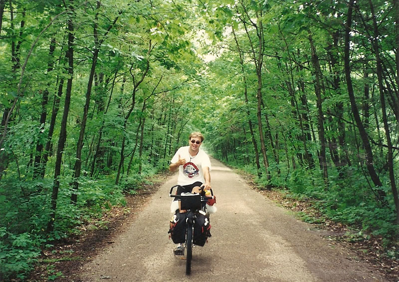
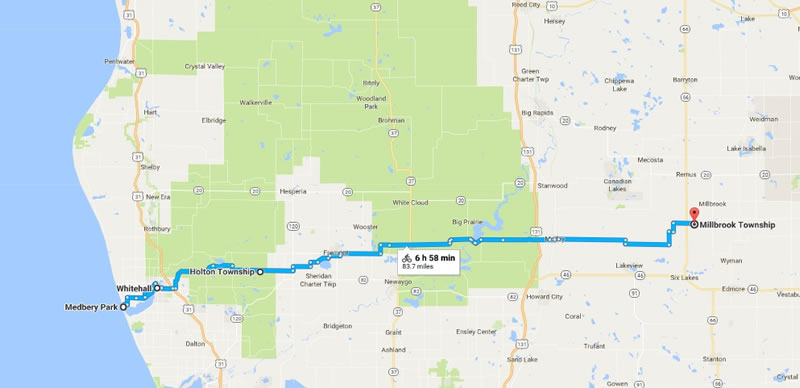
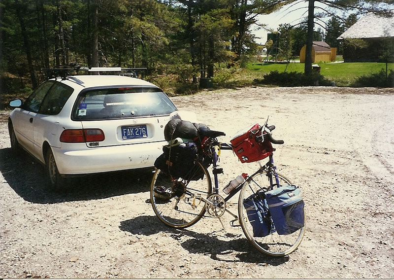
on a rails to trails bike path at around noon and arrived in South Haven at about 6 PM. They stopped in Bloomingdale and climbed up the rusty water tower on the way to South Haven. They rode bikes up near where Ted went camping with Chuck during a wind storm and put thier camping gear down and cycled around woods looking for a safe place to camp. As they rode back to their camp gear, Ted rode over a hill and noticed it was steeper than he thought. Ted put on my brakes and flow over my handle bars. He did a complete flip and somehow landed on his feet running down a hill. Not sure how he stayed on his feet and never fell to the ground. Terry was behind Ted and all he could see is Ted going airborne, he did not know Ted landed on his feet until he came to the top of the hill. He though Ted broke his neck or something, but Ted was fine. They set up thier tents and bike down to Van Buron campgrounds. They sat on the hill that overlooked the lake and watched the sun set. (bike 45.5 miles/ car 144.1 miles)
May 14, 1995
Ted and Terry packed up their gear and headed back to Kalamazoo at about 8:30 AM. They stopped and had banana-nut pancakes for breakfast in South Haven. They stopped at a beach and checked out the beach, the wave had big white caps (good wind). On the way back to Kalamazoo they stopped in Bloomingdale for a pop and in Kinderdal for a sandwich at “Not Just Pizza”. They made it back to Ted’s car by 3 PM.. It was a great weekend, no rain. (bike 41.8/ car since 5-13 321.1)
|
|
|
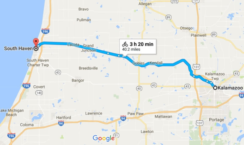
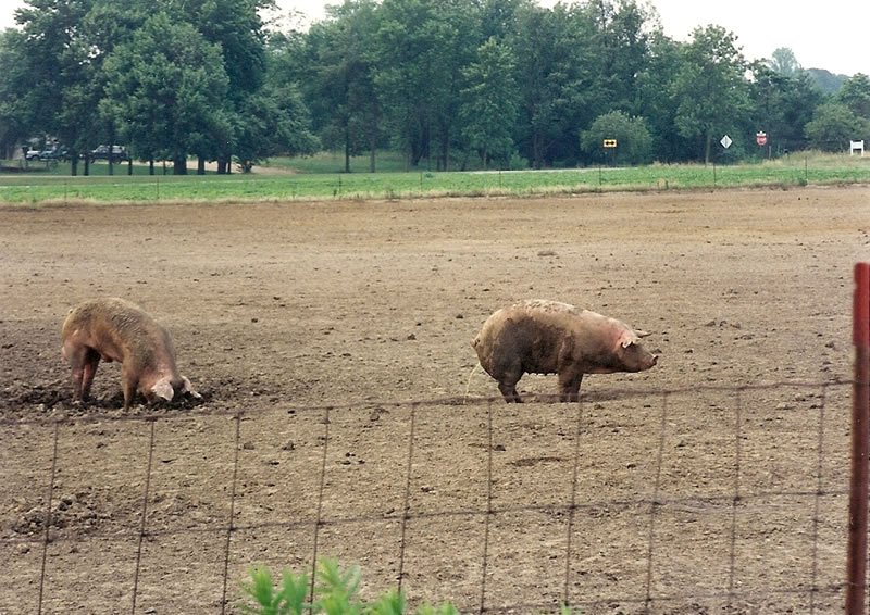
| Google map of Kalamazoo to South Haven's (Kal-Haven) rail to trails bike route. | Chuck cycling the Kal-Haven bike trial with his camping gear. | There are several farms along the Kal-Haven bike trail, here we see a pig taking a pee. |
|
|
|
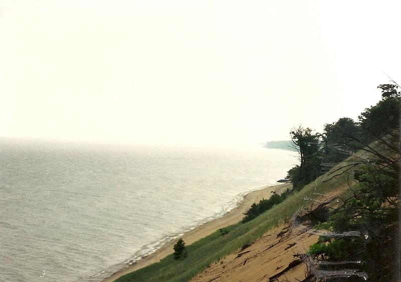
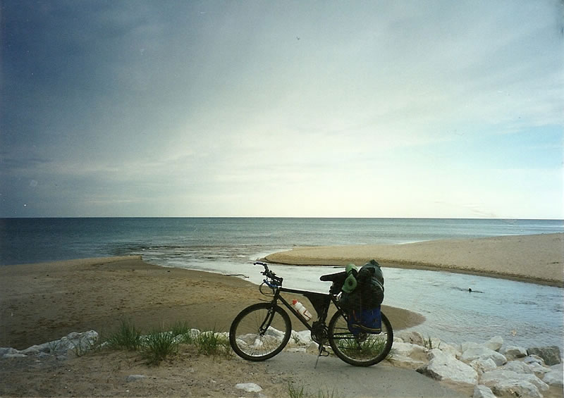
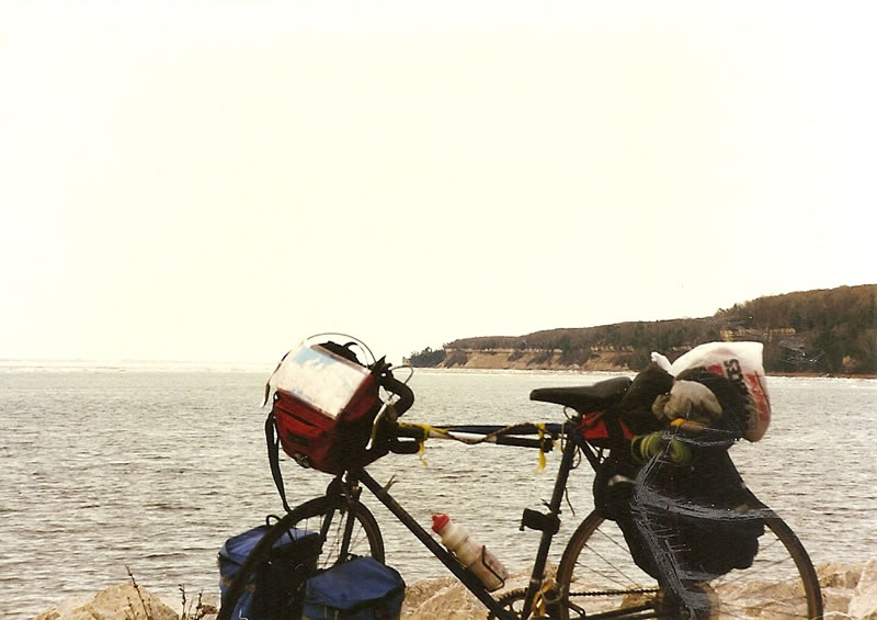
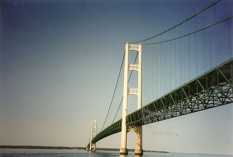
| Chuck getting into his tent near Lake Michigan. | View of Lake Michigan from near where Ted and Chuck stayed in Chuck's tent. We were in view of the lake and had no protection from the wind. | Terry cycling the Kal-Haven bike trail next to Ted's parked bike. Both bikes are loaded with camping gear. |
|
|
|
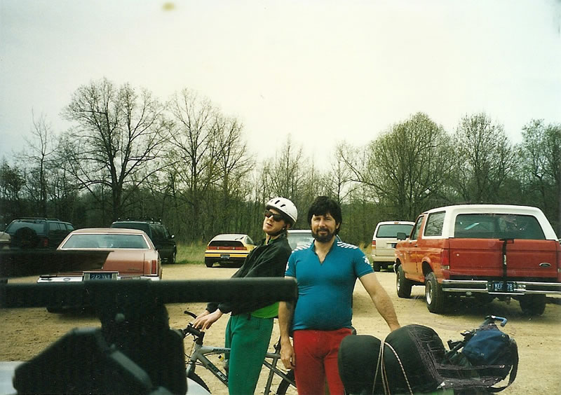
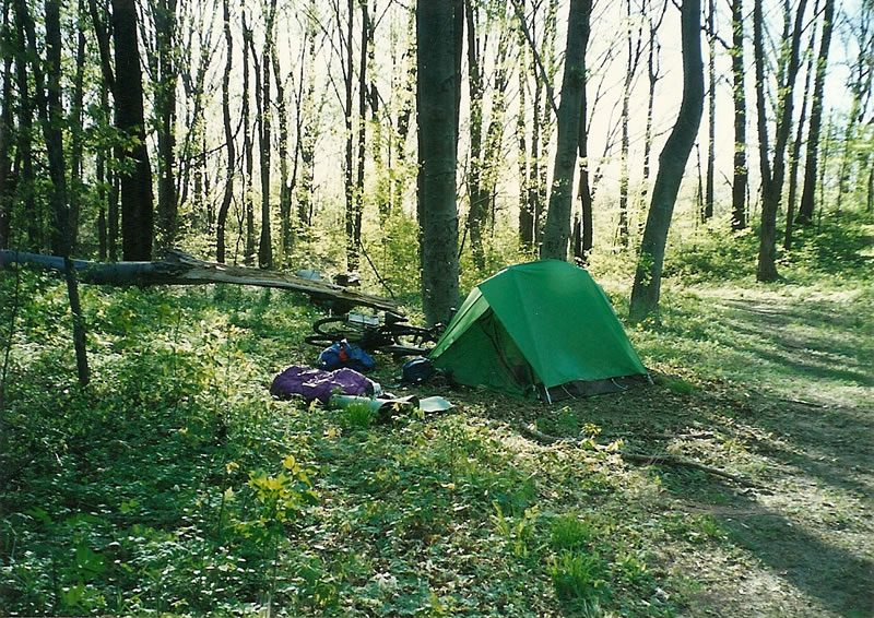
| Ted and Terry getting prepared to cycle to South Haven, Michigan. | Ted's tent set up for camping near Lake Michigan. | South Haven's Historic Lighthouse near city center of South Haven, Michigan. |
Across Lower Peninsula of Michigan; Todd’s to Mitch’s - Trip 3
Total miles biked on this trip 253.2 miles = 83.5 + 116.9 + 52.8
May 26,1995
Ted loaded his bike and camping gear into Todd Brandle Blazer. Todd drove Ted to Todd’s parent house near Whitehall, Michigan. Todd’s parent treated Ted like part of the family and gave Ted beer and pizza. Ted was planning a ride from Lake Michigan to Lake Huron. Todd’s parent house was a great starting place, it was near Lake Michigan.
May 27, 1995
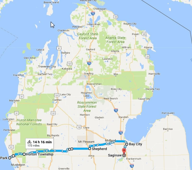
Ted woke up at about 6:45 AM and Todd woke up and offered Ted raisin brand for breakfast. Todd also offered Ted a ride to Lake Michigan, but Ted told Todd he could make it. The ride from Todd's parent house to Lake Michigan was 9.2 miles. Ted put his hand in Lake Michigan at 8:09 AM and started riding east. Ted saw a fox in the middle of the road and stopped to take a picture, but the fox got spooked and ran into the woods. Ted also saw a deer and a turtle in the road near Holton. When Ted crossed B31, Ted got turned around on the farm roads and biked for about 25 miles and ended up in the same place on B31. OOPS lost again! As Ted was riding near Crayton a pit bull came darting at him, so Ted swerved and almost got hit by a truck (which is worst the pit bull or truck?). Ted found a gas line road to camp at for the night near a Lutheran Bible chapter church at the corner of Jefferson and 230th Ave. Ted must have been close to someone's house, because Ted could hear a dog barking all night in the distance (Ted was probably downwind from the dog). (Total trip miles 83.5/ time 12.5 hours)
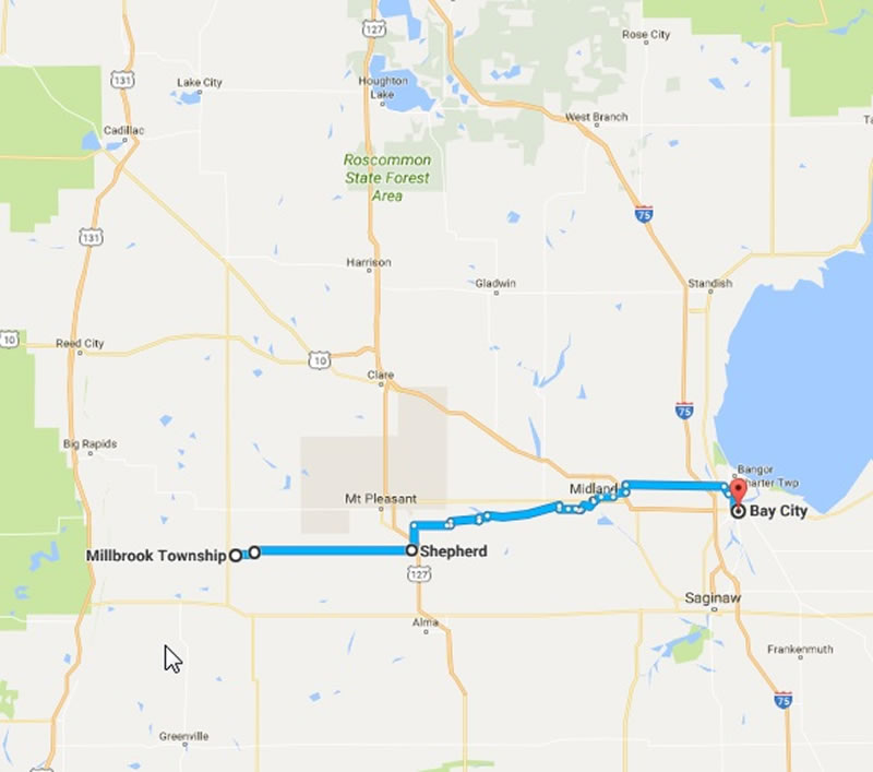
May 28,1995
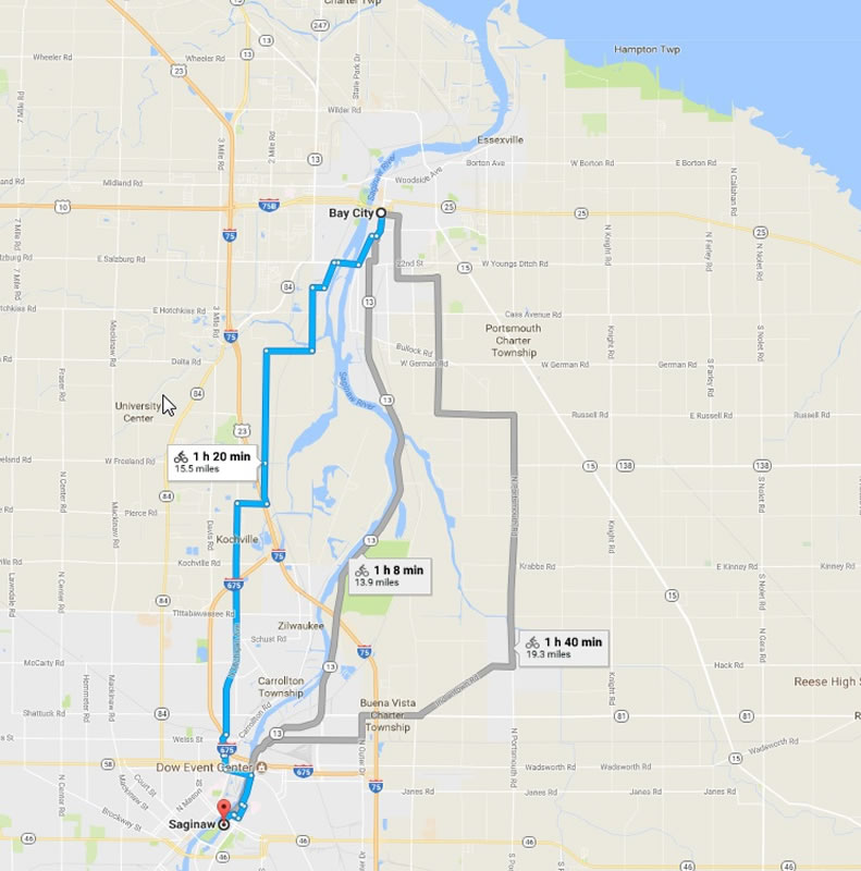
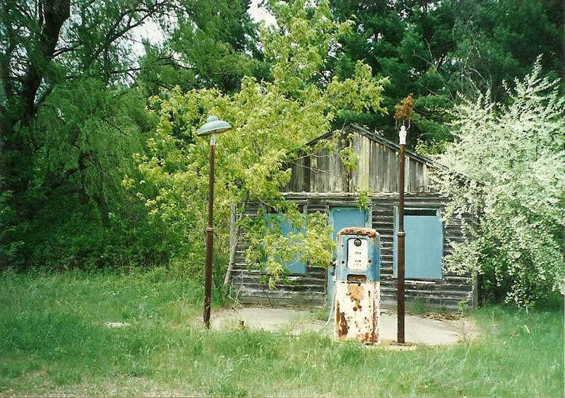
Ted left camp at 7:04 AM. In the town of Millbrook there was a neat old post office. Then in Blanchard there was some more neat historical stuff: old saw mill, train caboose and buildings. Ted stopped at the town of Shepard and asked for directions to Pleasant Valley. The two people Ted asked gave him different directions. The second man's directions were not on a dirt road and they were correct (don't ask how Ted knew that's just what his notes say, Ted’s notes were about 2 years old when he wrote the journal, most of the stuff he remembered). In Pine River Ted saw a lot of fish and a cool old abandoned gas station. Ted ended up getting lost on the way to Bay City. Ted was following some arrows on the road (Ted saw similar arrows on the highway west of that point and thought they were probably for the Michigander bike ride). Ted quit following the arrows and used his intuition. On that day Ted ended up with head winds for the first time, normally Ted had tail winds. Ted stopped at a store that had a sign that said use east entrance. Ted went to what he thought was east and the door was locked, then Ted went to where he though was north and it was opened, OOPS Ted was going south, not east (lost again!). Ted asked for directions and was told he could either go back 2 miles or go straight 4 miles and then back 2, Ted ended up riding an extra 4 miles. At that point Ted asked for directions again. After that Ted was able to follow the road to Bay City and Ted put his hand in Lake Huron at 8: 13 PM, mile 111 since leaving Todd’s parent house. Ted then called Mitch, to tell him he was in Bay City and would be at his house the next day. Ted’s feet were a little sore and his legs felt great. Ted had a 40oz Busch light beer and ate a turkey sandwich, with smooched bread from Whitehall, Michigan. (Bike miles 116.9)
May 29, 1995
Ted rode to the Lake Huron Nature Center where he saw neat white birds, big fish and a frog on the trail that went around the lagoon. Then Ted rode to McDonalds for breakfast, but it was too late (10:35 AM, breakfast was only served till 10:30 AM). As Ted was riding near Salzburg a friendly dog started chasing him. Ted turned and looked at the dog and noticed that the dog's owner was running after the dog. Ted stopped at the 7-11(at Mackinaw Street) near Saginaw and a man saw him looking at his map. He came over and gave Ted directions and left (he never even went in the store, nice man just came over to help Ted). Ted arrived at Mitch's house at 1:15 PM after biking 27.1 that day. Then Mitch gave Ted a ride to the bus station and Ted took the bus to Royal Oak. Ted arrived at the bus station in Royal Oak at about 7:30 PM and walked to Chuck's house to get his spare bike out of Chuck’s garage. Ted started riding to Todd Brandle's apartment to get his car, at about 11:30 PM Ted stopped at a store in Novi to get directions to Pontiac trail road. Ted finally made it to his car, put his bike in the car and then drove home. (Bike miles 52.8)
 |
 |
|
| Google map of Ted's bike ride across the Lower Peninsula of Michigan. Map details are estimate, the map was created in 2017 based on notes from 1995. | Approximate route Ted took on day one of his 1995 bike ride across the Lower Peninsula of Michigan. | Approximate route Ted took on day two of his 1995 bike ride across the Lower Peninsula of Michigan. |
 |
 |
|
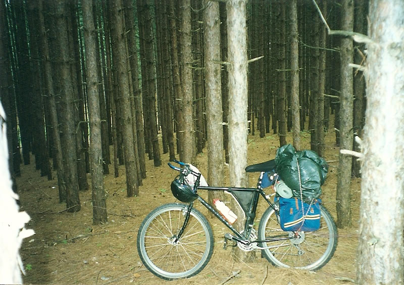
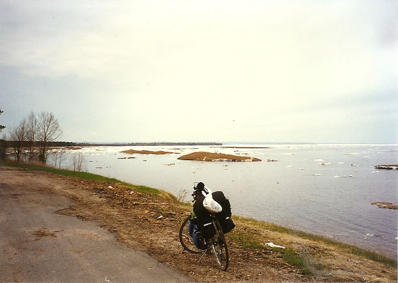
| Approximate route Ted took on day three of his 1995 bike ride across the Lower Peninsula of Michigan. | Ted bike loaded with Camping gear near Lake Michigan (Ted believes this is at Duck Lake State Park) | Ted bike loaded with Camping gear near Lake Michigan (Ted believes this is at Duck Lake State Park) |
 |
 |
|
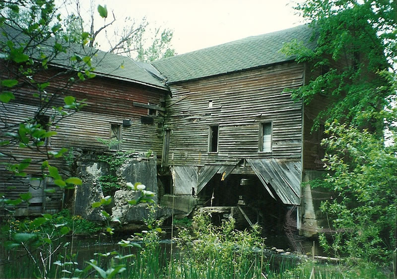
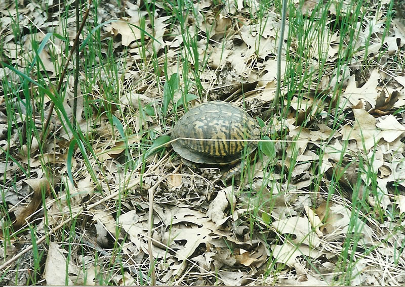
| A turtle Ted saw near Holton, Michigan. | Ted's bike when he was about to set up his campsite near Millbrook, Michigan. | This is believed to be an old sawmill near Blanchard, Michigan. |
 |
 |
|
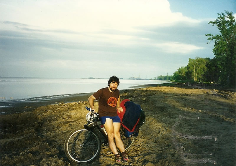
| Old gas station Ted saw near Pine River, Michigan. | Ted with his bike loaded with camping gear on Lake Huron near Bay City, Michigan. | Ted's bike with camping gear in Mitch Monroy's storage shed in Saginaw, Michigan. Mitch brought Ted his bike back to the Detroit area later that week. |
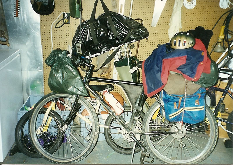
bike tour 4 (UP- prep for Alaska)
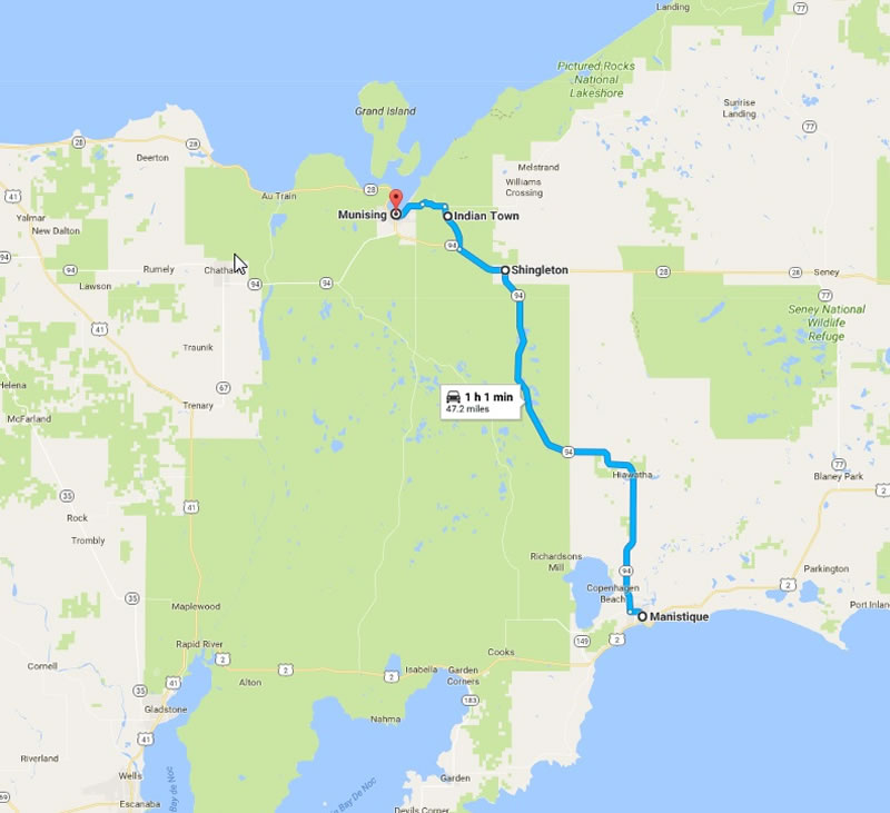
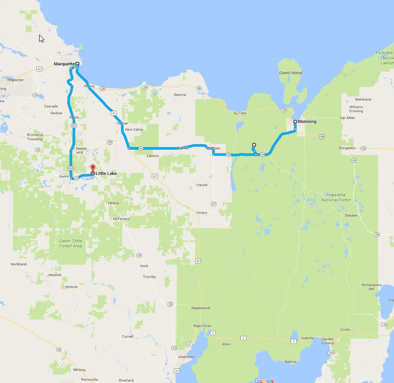
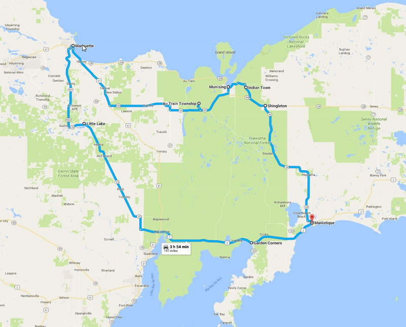
Across Upper Peninsula of Michigan; Prep for Alaska bike ride - Trip 4
Total miles biked on this trip 303.7 miles = 67.7 + 105.8 + 59.4 + 70.8
May 25, 1996
I drove to Manistique, MI in the UP to do a practice ride for my July Alaska trip. When I arrived in town, I rode my bike to the Police station to ask for suggestion for multi-day parking. The officer suggested that I park at the visitor center. The visitor center was closed, so I asked the people at the truck stop next to the visitor center, if I could park in their lot and they said it would be OK to park in the back corner of the parking lot. I biked around town a little and then I put my camping gear on my bike at the gas station parking lot. (I had already gone 6.3 miles on bike, before leaving Manistique). The ride to Shingletor was an easy ride on a road with a great shoulder and low traffic. I ate at a restaurant where I think the lady waitress liked me, she spilled ice on my table, suggested camping either at Miners Falls or she said I could camp behind the restaurant. At the turn off to Miners Fall a sign said no campground and another sign said 4 miles to falls and 6 miles to cliffs. I had been to Miners Falls in the past and decided it was not worth the ride to go visit. I did however ride to Munising falls, were I noticed there was still ice behind the falls. When I rode to Sand point I noticed Ice Burgs still floating in Lake Superior. I stopped at Munising City Park and noticed $11/ night camping available. That campground did not even have free showers and I decided to continue. I ended up camping very close to Christmas, Michigan. (bike miles 67.7/ car miles 382.7)
May 26, 1996
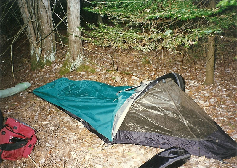
I biked along Lake Superior, there was still ice in the lake. I stopped at a gas station on the outskirts of Marquette and a man stopped at the gas station started telling me about all the bike tours that he had done and of course I told him about my bike tours (This type of interaction always seems to happen on bike tours, I do the same thing whenever I see someone with a bike loaded with camping gear). Then I asked him for directions to Gwin Geal road and he gave them to me. Near Little Indian a sheriff stopped to see if I was OK and I told him everything was great. He was a very friendly officer. I camped in the national forest about .6 miles from Nambe. That day my gullet got really swollen. (bike miles 105.8)
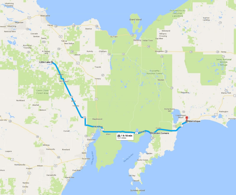
May 27, 1996; Monday
In the morning, my gullet was really hurting, it was tough to eat. I had breakfast at a restaurant in Garden Corner. I was having a tough time eating (it hurt if food went past my gullet). When I asked the waitress for more coffee, she said she would return in a minute, but never came back. I think she may not have liked the way I smelled, I stunk after biking for 3 days without a shower. I then biked to Fayetee were I saw a nice looking lady (nice looking about 30 years old) that was at the breakfast restaurant earlier, she said hello. Another lady, asked how far I biked and I told her about my ride and my planned Alaska ride. Then I biked back to Manistique (arrived at about 5 PM) to complete my 3 day loop ride. Then I went and ate at Big Boys restaurant. Then I drove back to Mackinaw and went camping at Wilderness state park. (bike miles 59.4, car total 500 miles)
 |
 |
|
| Google map of Ted's bike ride across the Upper Peninsula of Michigan. Map details are estimate, the map was created in 2017 based on notes from 1996. | Approximate route Ted took on day one of his 1996 bike ride across the Upper Peninsula of Michigan. | Approximate route Ted took on day two of his 1996 bike ride across the Upper Peninsula of Michigan. |
 |
 |
|
| Approximate route Ted took on day three of his 1996 bike ride across the Upper Peninsula of Michigan. | Ted's bike loaded with camping gear near Manistique, Michigan. Starting point of Ted's solo Michigan Upper Peninsula tour. | Ted's bike near Munising, Michigan looking towards sand point. |
 |
 |
|
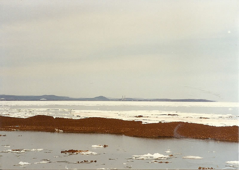
| Ted's campsite near Christmas, Michigan. | Ted's bike at the Upper Peninsula of Michigan with Lake Superior in the background. | Lake Superior in the Upper Peninsula of Michigan. |
 |
 |
|
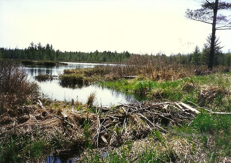
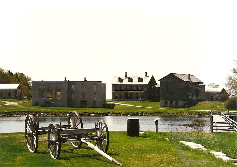
| Fayette Historic State Park in the Upper Peninsula of Michigan. | Beaver dam in the Upper Peninsula of Michigan. | The Mackinac Bridge which connects the Upper and Lower Peninsula of Michigan. |